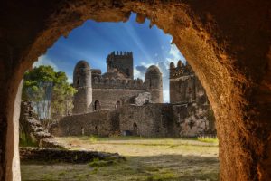
Cameroon: The Africa in miniature

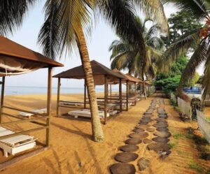
Kribi is home to Cameroon’s best beaches – the sand is fine, the water crystal clear. Kribi is a resort town and port in the South Province of Cameroon. It’s known for its sandy beaches. To the south, Tara Plage is a beach with strong Atlantic surf. Nearby, the Chutes de la Lobé waterfall plunges directly into the sea. Kribi is equally very popular for its roasted fish and one of the most beautiful cities in Cameroon.

Cameroon is well known for its native music styles, particularly Makossa and Bikutsi, and for its successful national football team
Republique du Cameroun (fr)
Republic of Cameroon (eng)
short form: Cameroun/Cameroon
formerly: French Cameroon, British Cameroon, Federal Republic of Cameroon, United Republic of CameroonISO Country Code: cmTime:
Local Time = UTC +1h
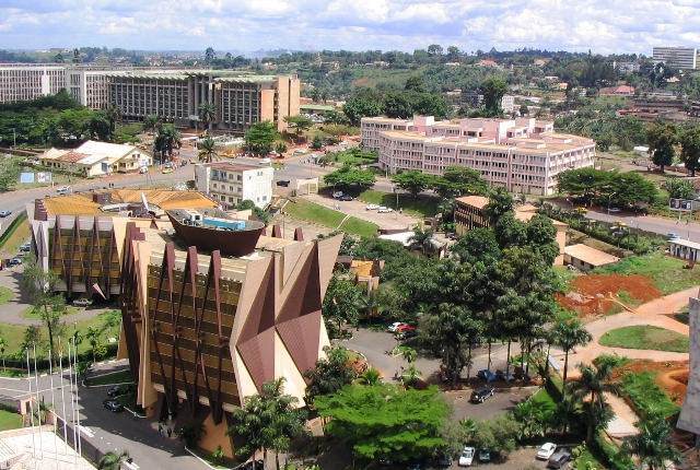
Actual Time: Tue-July-6 16:34Country Calling Code: +237Capital City: Yaounde (pop. 1.1 million)
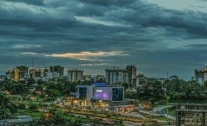
Other Cities: Douala, major seaport and commercial capital (1.3 million), Garoua (424,312), Maroua (409,546), Bafoussam (319,457), Bamenda (321,490), Nkongsamba (166,262), and Ngaoundere (216,300).
Government:
Republic; with a strong central government dominated by president.
Independence: 1 January 1960 (for areas formerly ruled by France) and
1 October 1961 (for territory formerly ruled by Britain).
Constitution: 2 June 1972, last amended in January 1996.
Geography:
Location: Central West Africa bordering the Bight of Biafra (part of the Gulf of Guinea and the Atlantic Ocean)
Area: 475,650 km² (183,650) sq. mi.).
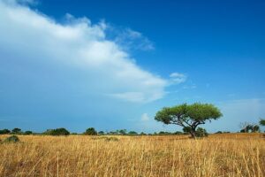
Terrain: Northern plains, central and western highlands, southern and coastal tropical forests. Highest peak: Mt. Cameroon (13,353 ft.).
Climate: Northern plains, the Sahel region–semiarid and hot (7-month dry season);
Central and western highlands where Yaounde is located–cooler, shorter dry season; southern tropical forest–warm, 4-month dry season; Coastal tropical forest, where Douala is located–warm, humid year-round.
People:
Nationality: Cameroonian(s); French noun and adjective–Camerounais(e).
Population (2016): 24 million
Ethnic groups: About 250.
Religions: Christian 53%, Muslim 22%, indigenous African 25%.
Languages: French and English (both official) and about 270 African languages and dialects, including pidgin, Fulfulde, and Ewondo.
Literacy: 75%
Image: Amcaja
Natural resources: Oil, timber, hydroelectric power, natural gas, cobalt, nickel.
Agriculture products: timber, coffee, tea, bananas, cocoa, rubber, palm oil, pineapples, cotton.
Industries: Petroleum production and refining, aluminum production, food processing, light consumer goods, textiles, lumber, ship repair
Exports – commodities: crude oil and petroleum products, lumber, cocoa beans, aluminum, coffee, and cotton.
Exports partners: China 16.7%, India 15.7%, Spain 6.2%, Belgium 6.1%, France 6.1%, Portugal 5.6%, Netherlands 5%, Italy 5% (2015)
Imports – commodities: machinery, electrical equipment, transport equipment, fuel, food, cereals, fish.
Imports partners: China 27.9%, Nigeria 13.9%, France 10.9%, Belgium 4.1% (2015)
Currency: Communaute Financiere Africaine franc (XAF)
The name Cameroon is derived from the Portuguese word, Camaroes, meaning shrimps. As Portuguese sailor Ferdanando Poo arrived in 1472 at the Wouri river in Douala and discovered so many shrimps in the river he decided to call it Rio Dos Camaroes (River of shrimps, in Portuguese). It was from this word that the territory derived its name which is now spelt in various forms: Spanish spelt it Cameroes; Germans, Kamerun; English, Cameroon; and French, Cameroun.The territory was colonized by the Germans in 1884 but after the end of the First World War Cameroon was mandated by the League of Nations to the French and British governments. France took the greater sector, formally known as East Cameroon, while Britain took responsibility over former West Cameroon known then as “Cameroon under British Administration”.
On January 1st 1960 the French Sector became independent under the new name of Cameroon Republic. Following agitation for independence by the Southern Cameroons – before the name was changed to West Cameroon – a plebiscite was held in that sector of Cameroon on February 11th 1961 under the United Nations supervision. The result of the plebiscite was overwhelming for reunification (233,571 against 97,741) and gave Southern Cameroon automatic independence and unification, which was achieved on 1 October 1961. Thus after the reunification of both sectors, the Federal Republic of Cameroon was born.
After a referendum in May 1972, Cameroon became a United Republic and by a Presidential Decree of 1984 it became the Republic of Cameroon.

Ethnic and linguistic composition
The country has been described as an “ethnic crossroads” because of its more than 200 different ethnic groups. There are three main linguistic groups: the Bantu-speaking peoples of the south, the Sudanic-speaking peoples of the north, and those who speak the Semi-Bantu languages, situated mainly in the west. The first Bantu groups included the Maka, Ndjem, and Duala.
They were followed at the beginning of the 19th century by the Fang (Pangwe) and Beti peoples. The Sudanic-speaking peoples include the Sao, who live on the Adamawa Plateau; the Fulani; and the Kanuri. The Fulani came from the Niger basin in two waves, in the 11th and 19th centuries; they were Muslims who converted and subjugated the peoples of the Logone valley and the Kébi and Faro river valleys. The Semi-Bantu groups mainly consist of small ethnic entities, except for the Bantu-related Bamileke, who live between the lower slopes of the Adamawa Plateau and Mount Cameroon. Other western Semi-Bantu-speaking groups include the Tikar, who live in the Bamenda region and in the western high plateau.
The oldest inhabitants of the country are the Pygmies, locally known as the Baguielli and Babinga, who live in small hunting bands in the southern forests. They have been hunters and gatherers for thousands of years, although their numbers have consistently diminished with the decline of the forests in which they dwell.
European missions and colonization led to the introduction of European languages. During the colonial era, German was the official language; it was later replaced by English and French, which have retained their official status.
In September 2016, separatists started a guerilla war for the independence of the Anglophone region as the Federal Republic of Ambazonia. The government responded with a military offensive, and the insurgency spread across the Northwest and Southwest regions. As of 2019, fighting between separatist guerillas and government forces continues. During 2020, numerous terrorist attacks—many of them carried out without claims of credit—and government reprisals have led to bloodshed throughout the country. Since 2016, more than 450,000 people have fled their homes. The conflict indirectly led to an upsurge in Boko Haram attacks, as the Cameroonian military largely withdrew from the north to focus on fighting the Ambazonian separatists.