Lesotho the Roof of Africa

Kingdom of Lesotho
short form: Lesotho
former: BasutolandISO Country Code: lsActual Time: Fri-Jan-21 07:38
Local Time = UTC +2h
Country Calling Code: +266
Capital City: Maseru (1997 pop. est. 386 000)
Teyateyaneng (pop. est. 240 754), Leribe (300 160), Mafeteng (211 970), Mohale’s Hoek (184 034).Government:
Type: Modified constitutional monarchy.
Independence: 4 October 1966. (from 1868 until independence Lesotho was placed under British protection.)
Location: South Africa
Area: 30,355 sq. km. (11 718 sq. mi.).
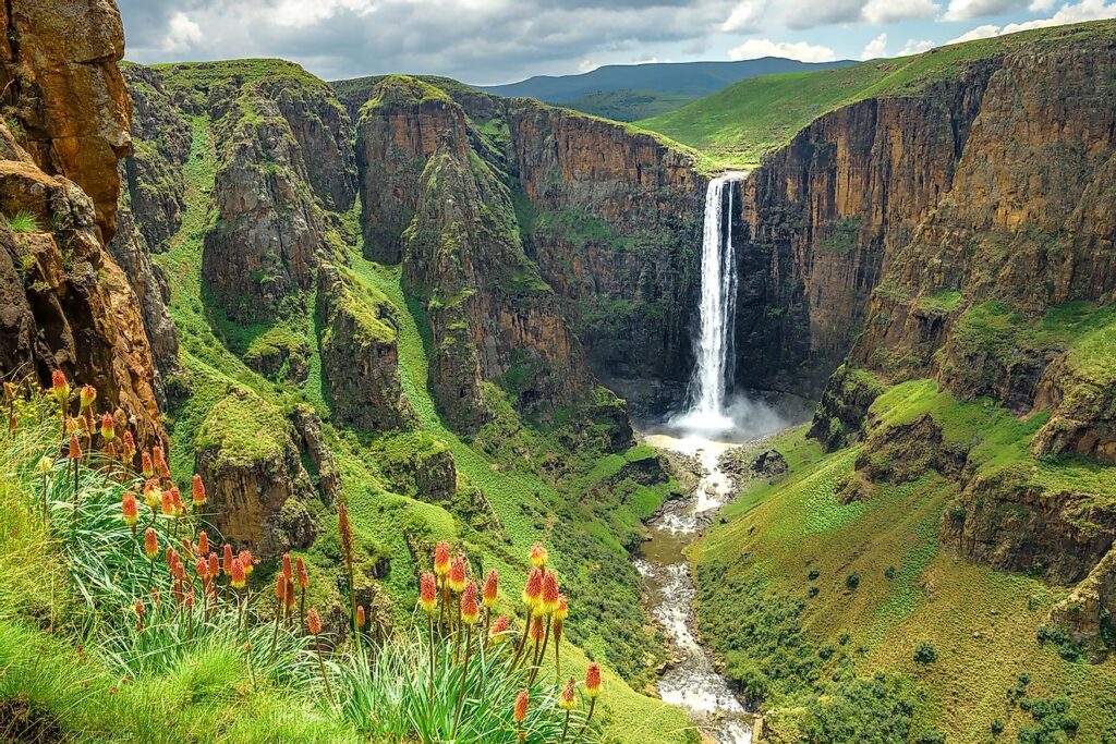
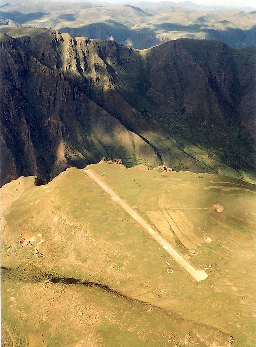
Terrain: High veld, plateau and mountains.Climate: Temperate; summers hot, winters cool to cold; humidity generally low and evenings cool year round. Rainy season in summer, winters dry. Southern hemisphere seasons are reversed.People:
Nationality: Noun–Mosotho (sing.); Basotho (pl.) Adjective–Basotho.
Population: 2.2 million (2010, UN estimate)
Ethnic groups: Basotho 99.7%; Europeans 1,600; Asians 3,000.
Religions: 80% Christian, including Roman Catholic (majority), Lesotho Evangelical, Anglican, other denominations.
Languages: Official–Sesotho and English. Others–Zulu, Xhosa.
Literacy: (1998) 70%.
Natural resources: Water, agricultural and grazing land, some diamonds and other minerals. Lesotho is an exporter of excess labor.
Agriculture products: Corn, wheat, pulses, sorghum, barley; livestock.
Industries: Food, beverages, textiles, apparel assembly, handicrafts; construction; tourism.
Katse Dam and Botanical Gardens

Exports partners: USA 97.6%, Canada 1.5%, France 0.5% (2003)
Imports partners: Hong Kong 36.6%, Taiwan 36.2%, China 12%, Germany 9.9% (2003)
Currency: In 1980, Lesotho introduced its own currency: Loti (plural Maloti). It is equivalent to the South African Rand.


For administrative purposes, Lesotho is divided into ten districts, each headed by a district administrator. Each district has a capital known as a camptown.
The districts are subdivided into 80 constituencies, which consist of 129 local community councils.
According to Wikipedia, Lesotho has taken advantage of the African Growth and Opportunity Act (AGOA) to become the largest exporter of garments to the US from sub-Saharan Africa. US brands and retailers sourcing from Lesotho include: Foot Locker, Gap, Gloria Vanderbilt, JCPenney, Levi Strauss, Saks, Sears, Timberland and Wal-Mart. In mid-2004 its employment reached over 50,000, mainly female workers, marking the first time that manufacturing sector workers outnumbered government employees. In 2008 it exported goods worth 487 million dollars mainly to the US. Since 2004, employment in the sector has dwindled to about 45,000 in mid-2011 due to international competition in the garment sector. It was the largest formal sector employer in Lesotho in 2011.

Lesotho’s significant natural resources are water and diamonds are. Water is used through the 21-year, multibillion-dollar Lesotho Highlands Water Project (LHWP), under the authority of the Lesotho Highlands Development Authority. The project commenced in 1986. The LHWP is designed to capture, store, and transfer water from the Orange River system to South Africa’s Free State and greater Johannesburg area, which features a large concentration of South African industry, population, and agriculture. Completion of the first phase of the project has made Lesotho almost completely self-sufficient in the production of electricity and generated approximately US$70 million in 2010 from the sale of electricity and water to South Africa. The World Bank, African Development Bank, European Investment Bank, and many other bilateral donors financed the project.
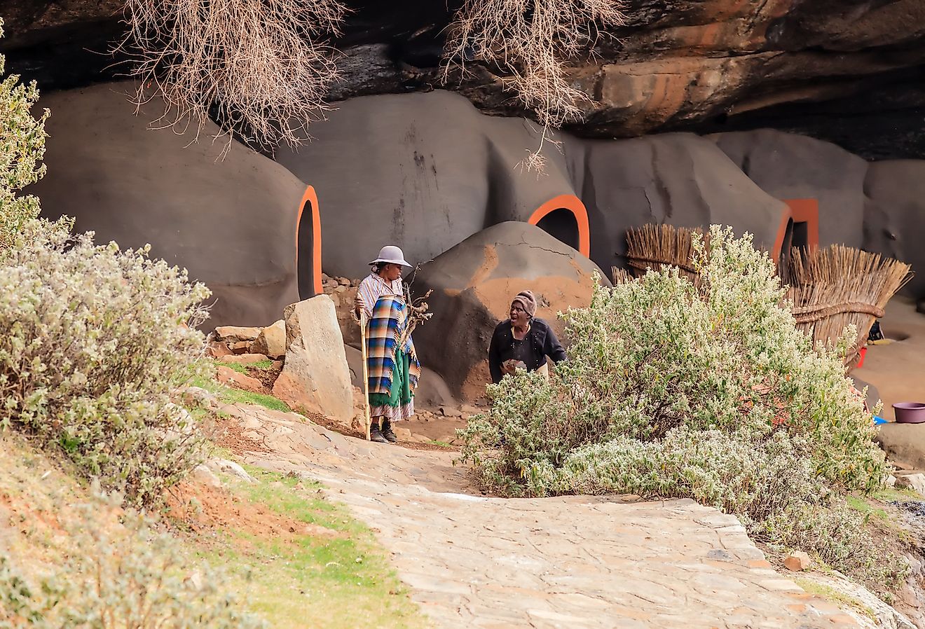


According to World Atla, In the district of Berea in Lesotho, a group of people still live in mud caves in the mountains. The cave dwellings found here were built in the first half of the 19th century by a local tribal chief named Chief Teleka. He belongs to the Basia clan residing in the region. The caves were built so that his people could hide from the invading Basotho people. The Basotho had resorted to cannibalism following a late 18th-century drought in their area of living. Today, the Kom Caves are also visited by tourists from all corners of the globe.
Lesotho have a festival each year that is put on by the government and the royal family, called the Morija Arts and Cultural Festival. It lasts for five days and the theme is “Unify in Diversity.” The festival features drama, poetry, traditional dance, art and music. Traditional instruments are the lekolulo, a kind of flute used by herding boys, and the stringed thomo, that woman play. The festival, of course, also features their cuisine.

Culture
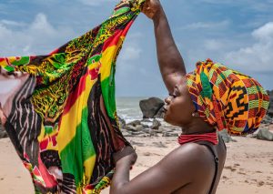
The Basotho people have developed a unique culture. As one of the few African tribes living in a mountainous environment, they have made many adaptations to their conditions. The Basotho blanket is one example. All around the country you will see people dressed in woollen blankets, often with beautiful patterns. This is the ideal garment for a cold environment, and also has the versatility of keeping the rain off.
Villages are often located high in the mountains, usually on the mid-levels well above the deep river valleys and the flood dangers they carry. Villages are very structured. They are made up of a number of kraals, ie. a collection of buildings belonging to one family. Some are for sleeping, some for storage and one for cooking. Each kraal will also have an enclosure for livestock. Each village has a chief, or headman, who will fall under the chief for the area.

The Basotho are agriculturalists. All around the village will be many fields and these are allocated by the chief to villagers. Many crops are cultivated including maize, wheat, sorghum, beans and peas as well as vegetables such as onions and cabbage. Many local herbs are also gathered as green vegetables, which the Basotho call Moroho.
Animals are very important in Basotho society. The Basotho pony represents the best form of transport in the mountains, and donkeys are often used as pack animals. Most families will have some cattle, and oxen are used to plough the sloping mountain fields. Wool is a major source of income both from Memo sheep and mohair from Angora goats, and you will see many herds of both deep in the mountains. They are looked after by shepherds, often young boys, who live in simple huts called motebo, often perched on ridges at well over 3000m and very well hidden.
Passing a village you will frequently see a flag flying from a tall pole. This indicates a place where something is being sold. A white flag means “joala”, a locally brewed sorghum beer. Yellow means maize beer, red means meat and green means vegetables.
African Highest Pub
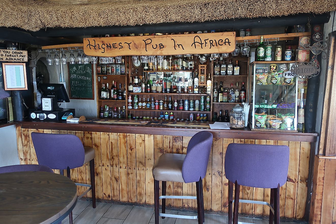
The Sani Mountain Lodge in the Sani Pass is regarded as Africa’s highest pub. Here tourists enjoy a drink above the clouds. The pub is, in fact, located at the border between Lesotho and South Africa. The Sani Pass connects these countries. The pub has an elevation of 2,874 m or 9,429 ft. Drinking here is like drinking in two countries at the same time.
Sources: Wikipedia, Britannica, NationOnline, crazytourist.com, Theblanketwrap.com, asabbatical.com, Internationalcuisine.com,